Aerial Photography Houston: Revolutionizing Real Estate and Construction with Austin Visuals
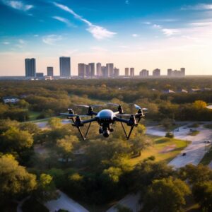 If you’re in search of professional Houston Drone Photography services, consider Austin Visuals. Specializing in aerial photography, we utilize our expertise and top-notch equipment to produce high-quality photographs, factoring in flying height, camera focal length, and atmospheric conditions.
Research by multiple listing services shows that properties with aerial images sell faster. Austin Visuals offers an affordable and effective solution to make your listings stand out. Reach us at 512-591-8024 or email us at [email protected] to give your listings a competitive edge.
Houston Drone Photography for Real Estate
Aerial photography for real estate, provided by Austin Visuals, is a powerful tool for showcasing properties, emphasizing unique features, and spotting potential issues like drainage problems. Drone photography captures stunning high-resolution images that enhance your listings, giving potential buyers a unique perspective.
Using drone photography in your marketing strategy sets your property apart from the competition. This is particularly advantageous when selling large acreage properties, where conveying the scale is a challenge.
Houston Drone Photography for Construction
For construction projects, drone photography should be a vital part of your strategy. Drones offer an unparalleled perspective of projects, aiding in planning, monitoring progress, and identifying potential problems early on.
Monitoring progress and accountability become straightforward with a bird’s-eye view, providing managers with the needed information to make on-the-spot decisions and keep projects on track. This approach is safe, cost-effective, and efficient for capturing high-resolution images of extensive or difficult-to-access sites.
Houston Drone Photography for Marketing
Whether you’re selling land or homes, aerial photography infuses an innovative touch to your marketing materials. Aerial shots captured by our skilled photographers provide unique perspectives of property features, such as acreage, amenities, and landscaping.
Factors like weather conditions and atmospheric effects are taken into account to produce the perfect images for your needs.
Houston Drone Photography for Insurance
Aerial photography also plays a crucial role in insurance assessment. High-resolution aerial images provide valuable insights unattainable with ground photography. With an aerial view, potential water damage due to roof leaks, wildfire risk, surrounding vegetation, or structural issues needing further inspection can be identified.
Depending on their intended use, aerial photographs can be produced in various formats and scales. Austin Visuals also provides orthorectified photographs to correct for terrain distortions, providing map features useful at an engineering detail level.
So, for a unique and effective way to showcase your properties or construction projects, choose Austin Visuals, your trusted partner in Houston Drone Photography. Contact us at 512-591-8024 or email us at [email protected] to discuss your project today.
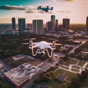
Here are just some of the use cases for Aerial Photography Houston Services
- Real Estate Listings: Aerial drone photography provides unique perspectives of properties, enabling potential buyers to visualize the layout and surrounding areas effectively. It’s especially valuable for showcasing large estates or properties with extensive outdoor features.
- Construction Site Monitoring: Drones can capture comprehensive views of construction sites, helping to track project progress, identify potential issues, and provide updates to clients.
- Agricultural Surveying: Drones can capture high-resolution images of agricultural fields, helping farmers monitor crop health, track growth progress, and identify problem areas.
- Event Coverage: Drones can capture stunning aerial footage of events like weddings, festivals, concerts, and sports events, providing a unique perspective that enhances the coverage.
- Film and Television Production: Drone photography is increasingly used in the film and TV industry for capturing high-definition aerial shots that would be costly or challenging to obtain with traditional methods.
- Environmental Research and Conservation: Drones can be used to monitor wildlife, track migration patterns, study environmental changes, and aid in conservation efforts.
- Insurance Inspections: Drones can safely inspect properties for insurance purposes, assessing damage after natural disasters or accidents without the need for an adjuster to physically enter a potentially unsafe area.
- Tourism Promotion: Drone photography can create breathtaking images and videos of tourist attractions, resorts, and landscapes, enhancing promotional materials and websites.
- Infrastructure Inspection: Drones can provide a safe and cost-effective way to inspect infrastructure like bridges, towers, wind turbines, and solar panels. They can access hard-to-reach areas, reducing risk and increasing efficiency.
- Land Surveying: Drones can cover large areas quickly and accurately, making them perfect for topographical surveys, land inspections, and mapping. They can provide valuable data for urban planning, landscape design, and scientific research.
- Medical
