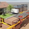

Looking for the best Animation Studios in Dallas? We have made a list of the top Animation and Graphics Companies in the Dallas Area. If you are looking to make a custom graphics or animation project we hope this list shortens your time on who to call. So let’s get started. Austin Visuals 3D Animation Studio – Austin Visuals has…