Client Overview
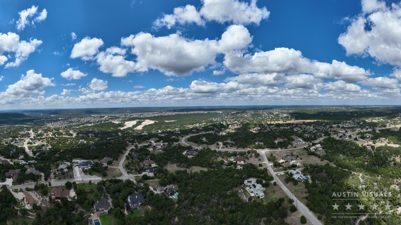
An independent real estate agent approached Austin Visuals Animation Studio with a unique project. The agent was assisting a friend in selling a plot of land located in North Austin/Leander, Texas. The property, nestled within the beautiful Texas Hill Country, offered natural beauty, including valleys and peaks, which the agent wanted to showcase through aerial photography. The drone images would be used to market the property on the MLS (Multiple Listing Service), attracting potential buyers who might see the land as an ideal development opportunity.
Challenges
The project presented several challenges:
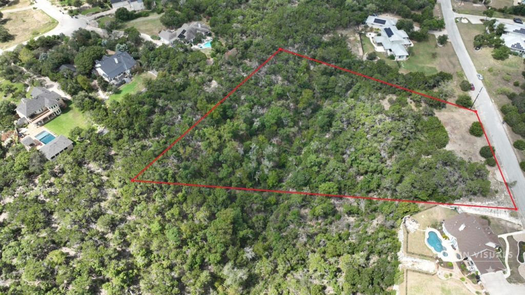
- Property Boundary Mapping: The agent provided a scanned paper map that included property boundary lines and topographic features. However, the map wasn’t overlaid with an aerial view of the area, which complicated the process of marking boundaries accurately on the drone photos.
- Variety of Shots: The agent required multiple angles, including photos just above the tree line to showcase the land’s expansive views, as well as images where the approximate property lines were drawn for clarity.
- MLS Compatibility: The photos needed to be optimized for upload to the MLS listing platform, requiring specific file formats and resolutions.
Solution
Austin Visuals designed a comprehensive approach:
- On-Site Collaboration: A drone pilot from Austin Visuals met with the real estate agent on-site, ensuring that the client could directly supervise and provide feedback on the shots in real-time. This collaboration helped capture the precise angles and views the agent desired.
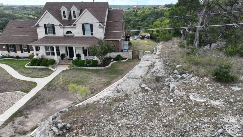
- Drone Photography: Using a DJI Mavic 3 drone, Austin Visuals captured a variety of aerial shots from multiple perspectives, including panoramic views above the tree line and close-up shots of cleared areas on the property.
- Property Boundary Overlay: After capturing the raw drone images, Austin Visuals returned to the office and digitally scanned the agent’s map. By overlaying the map on the aerial photos, the team was able to manually draw approximate property boundary lines on 1-2 selected images.
- File Preparation for MLS: Austin Visuals worked remotely with the agent to ensure that the drone images were delivered in the correct format and resolution for easy upload to the MLS system.
Execution
The project was executed efficiently and quickly, with the entire on-site drone photography session taking approximately 30 minutes. Key steps included:
- Photo Capture: Aerial photos were taken from different heights and angles to highlight the natural beauty of the land, including shots showing potential views for future developments.
- Boundary Line Addition: Austin Visuals overlaid the scanned map onto selected drone images and manually added property lines, ensuring accuracy and clarity.
- File Delivery: The files were shared with the client in the format required for MLS listings, with clear instructions on how to access and download the images.
Results
The final drone images were a success, delivering:
- Enhanced Property Marketing: The high-quality, detailed drone photos highlighted the unique selling points of the land, including its natural beauty and development potential.
- MLS-Ready Photos: The images were optimized for the MLS platform, making it easy for the real estate agent to upload and showcase the property effectively.
- Client Satisfaction: The client was extremely pleased with the process and the final product. The combination of clear property boundaries and stunning aerial shots gave the agent the marketing assets needed to attract potential buyers.
Client Testimonial
“Austin Visuals made the entire process so smooth and easy. They knew exactly what was needed to capture the land in the best possible way, and their expertise really shows in the photos. The drone shots and boundary lines were perfect for marketing the property on MLS.” – Real Estate Agent
Conclusion
This case study demonstrates Austin Visuals’ ability to deliver professional, high-quality drone photography solutions for real estate marketing. By combining their technical expertise with a client-centered approach, Austin Visuals successfully provided a set of MLS-ready images that captured the essence of the property, from boundary clarity to scenic views.