
Mineral exploration depends on evidence that is often spread across maps, drill logs, assays, core photos, geophysical data, resource models, field reports, and technical presentations. Those materials are essential, but they can be difficult for non-geologists to interpret. A 3D animation can bring them together into a clear visual sequence that shows terrain, drill holes, stratigraphy, target zones, and resource potential in context.
For exploration companies, mining consultants, engineering firms, and investment teams, animation is useful because mineral projects need both technical clarity and audience confidence. A geologist may understand the data from a static section, but an executive, investor, landowner, permitting group, or community stakeholder may need a stronger visual bridge.
Austin Visuals helps create that bridge with accurate, grounded, and presentation-ready animation. If your team needs to explain a mineral project clearly, reach Austin Visuals at info@austinvisuals.com or (512) 591-8024.
What Is 3D Animation for Mineral Exploration?
3D animation for mineral exploration is the use of animated terrain models, drill hole traces, geologic sections, block models, geophysical overlays, and resource visuals to explain an exploration project. It can be used for investor decks, technical meetings, public communication, stakeholder presentations, training, permitting support, and internal decision-making.
The animation does not replace geological interpretation. It helps communicate that interpretation. A good mineral exploration animation shows the relationship between data points, geologic assumptions, target zones, and project strategy. It can show why a drilling campaign is being proposed, how the current resource model was interpreted, where uncertainty remains, and what the next exploration step may test.
The best visuals are technically restrained. They should avoid exaggerated glowing ore, fantasy minerals, or impossible subsurface shapes. Instead, they should use clear camera movement, honest scale, simplified but plausible geology, and visual cues that help the audience understand the project without being misled.
Why Mineral Exploration Is Hard to Explain With Static Maps
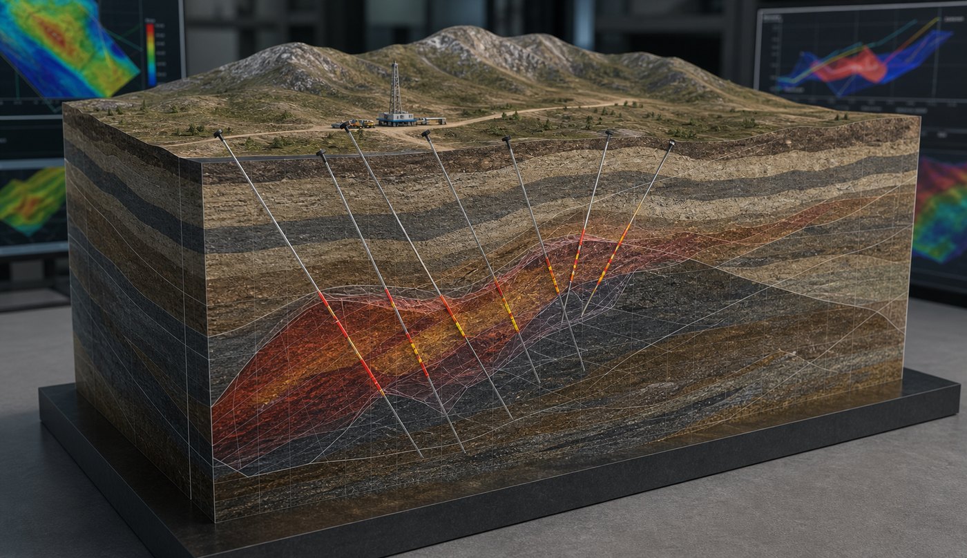
Exploration data is spatial. A drill hole has a collar location, depth, angle, assay intervals, lithology, alteration, structure, and relationship to surrounding holes. A map may show collar locations. A section may show vertical relationships. A block model may show resource estimates. But the full picture often requires the viewer to mentally assemble several views at once.
That is difficult for audiences outside the technical team. Investors may understand that drilling matters but not how drill spacing affects confidence. Community stakeholders may understand surface impact but not the subsurface target. Executives may want to compare several targets quickly. New team members may need a faster orientation to the property.
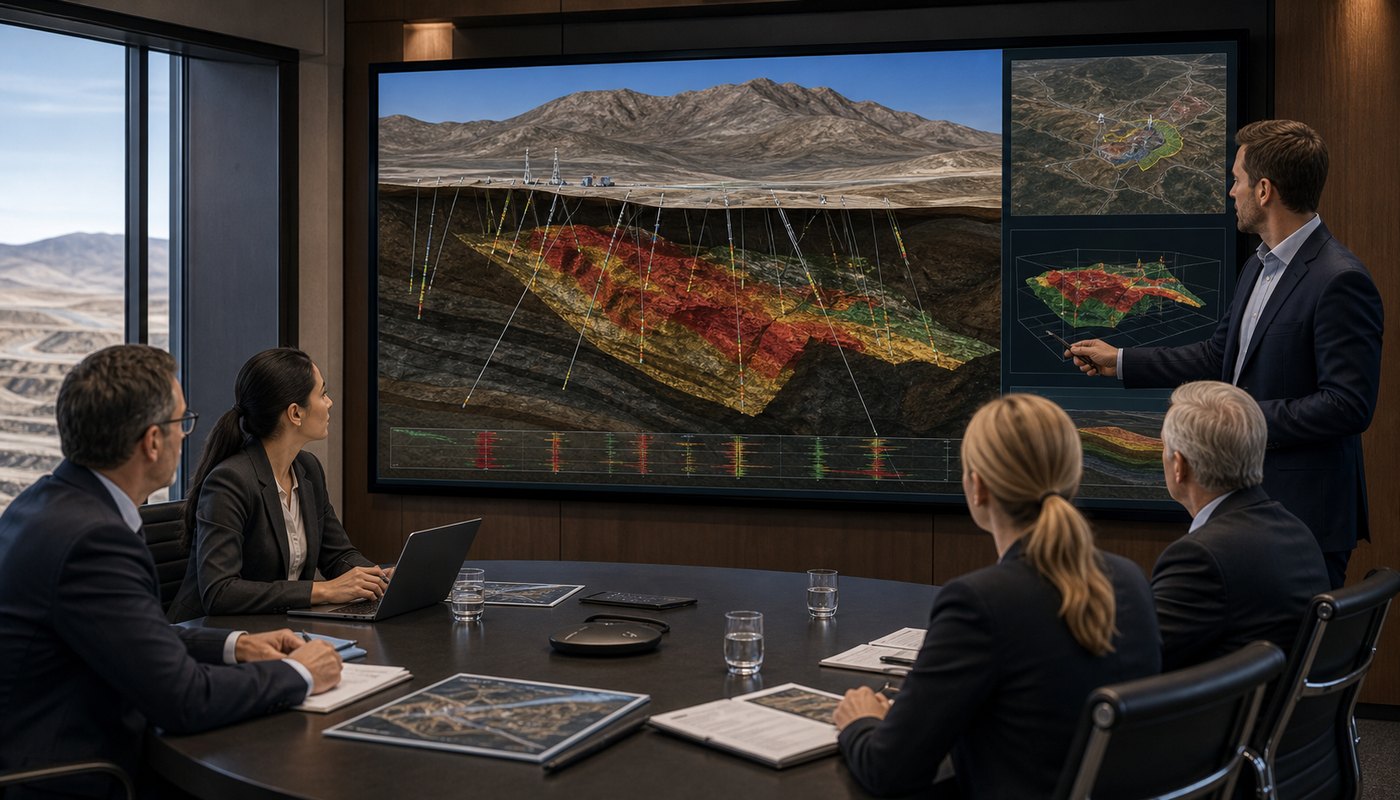
Animation solves this by moving through the project step by step. It can begin with regional location, zoom into the property, reveal terrain, show drill traces, add interpreted geology, highlight target zones, and then connect the visual to resource estimation. Each layer appears when the viewer needs it.
This is closely related to mineral resources visualization animation, where the goal is to make complex subsurface information more understandable while preserving the logic behind the interpretation.
How Animation Supports Drill Planning and Target Communication
Drill planning is one of the clearest use cases for mineral exploration animation. A planned hole is not just a line on a map. It represents a hypothesis about geology, structure, mineralization, depth, and continuity. Animation can show that hypothesis in a way that is easier to discuss with technical and non-technical stakeholders.
A mineral exploration animation can show existing holes, proposed holes, target envelopes, cross sections, and interpreted structures. It can also compare drilling phases: what was known before drilling, what new data was collected, and how the interpretation changed. This helps the audience see exploration as a disciplined process rather than a series of isolated drill results.
For internal teams, mining exploration visualization can support planning meetings. Teams can review target priority, drilling constraints, access routes, terrain, and data gaps. For external audiences, it can explain why the next drilling program matters and what it is intended to test.
Animation is especially useful when the project contains multiple targets or deep geometry. Instead of forcing the viewer to jump between plan maps and cross sections, animation can rotate around the target, cut through the model, and show how each drill hole relates to the broader interpretation.
Resource Estimation Animation and Block Model Communication
Resource estimation is often difficult to explain because it involves data density, geological interpretation, grade distribution, classification, assumptions, and uncertainty. Technical reports may cover those details, but many audiences need a visual overview before they can follow the numbers.
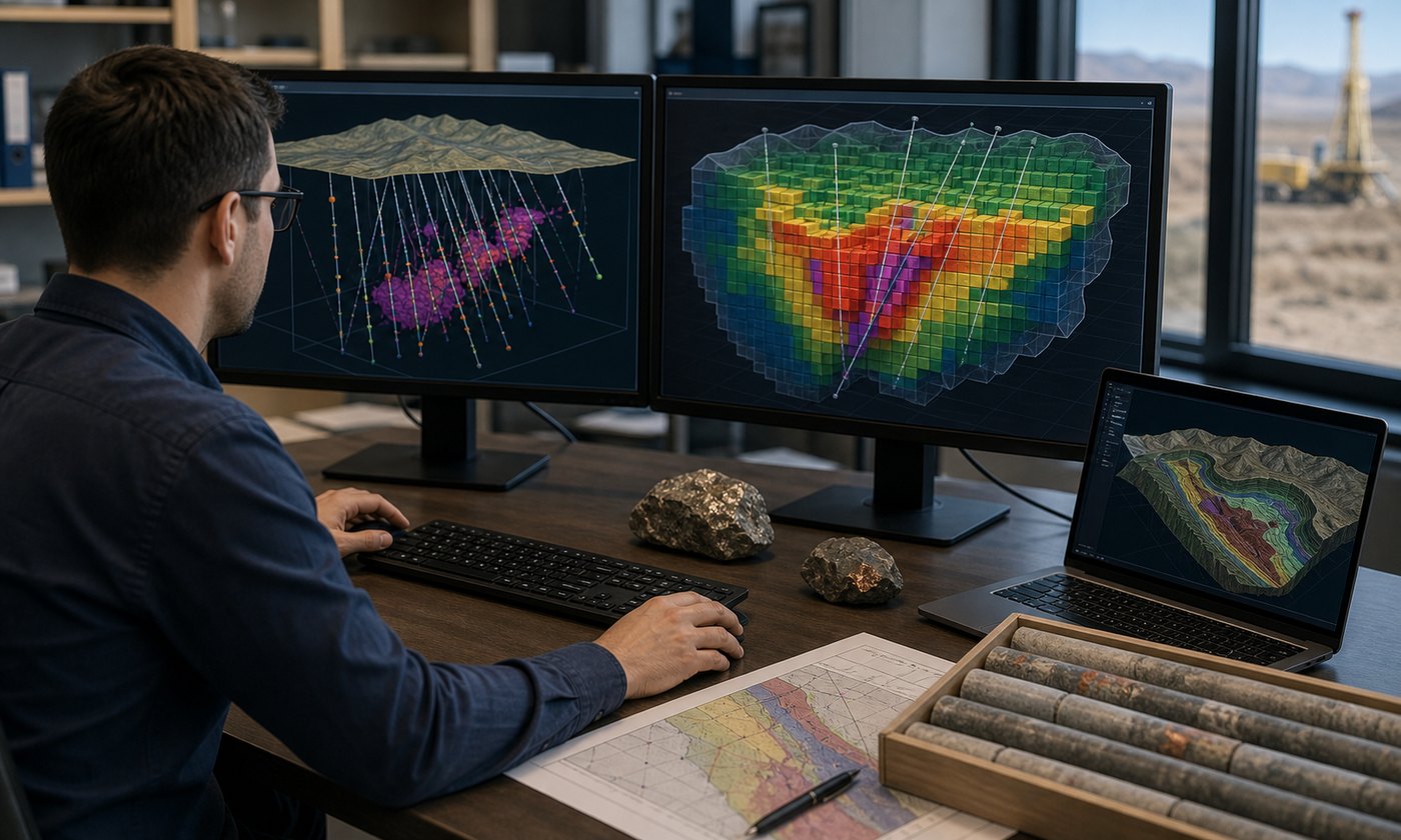
Resource estimation animation can show drill holes entering the model, mineralized intervals, interpreted shells, block model volumes, grade distribution, and classification zones. It can also show the difference between measured, indicated, and inferred areas in a simplified and careful way, when that is appropriate for the project and reviewed by the technical team.
The goal is not to make the resource look larger or more certain than it is. The goal is to explain how the model is organized. A clear animation can show where data supports confidence, where drilling is sparse, and where additional work may improve the model. This makes discussions more productive for management, investors, and consultants.
For mining projects that later move from exploration into development or processing, animation can connect naturally with 3D animation for mineral processing and mining operations. The early exploration model can become part of a broader visual system that explains the project from discovery through production.
Investor and Stakeholder Presentations
Mineral exploration companies often need to tell a clear project story without oversimplifying the science. A mining investor presentation animation can help by showing the property, the geologic setting, the exploration history, the current target, and the next milestone in a concise sequence.
Investor audiences may not need every technical detail, but they do need to understand why the project matters. Animation can show scale, access, drill progress, mineralized zones, and resource potential in a way that supports a disciplined narrative. It can also help distinguish a project from competitors that rely on static maps and dense slide decks.
Stakeholders outside the investment audience may also benefit. Local communities, landowners, permitting groups, and internal leadership may need different versions of the same visual. For one audience, the focus may be geology. For another, it may be land use, project footprint, or development sequence.
Because animation can be edited into different versions, one core 3D model can support investor updates, technical videos, conference loops, web content, and internal presentations. That makes the production investment more flexible than a single static graphic.
Data Sources Used in Mineral Exploration Animation
Mineral exploration animation can be built from many types of source material. Common inputs include GIS files, terrain data, drill collar tables, downhole survey data, assay intervals, lithology logs, geophysical interpretations, geochemical data, sections, maps, block models, mine planning files, site photos, drone imagery, and technical report figures.
Not every project needs every source. A conference overview may need a simplified terrain model and drill traces. A technical animation may need more detailed sections and resource model geometry. A stakeholder video may need surface context, access roads, and project boundaries. The level of detail should match the communication goal.
Data cleanup is often part of the workflow. Exploration data may come from different software platforms, coordinate systems, or consultant teams. Before animation begins, the production team and technical reviewers should agree on what data is authoritative, what can be simplified, and what should remain out of the visual.
This is where engineering-grade 3D visualization matters. The animation must be clear enough for communication, but grounded enough that technical reviewers are comfortable with what it shows.
Choosing the Right Visual Style
Mineral exploration visuals can range from highly technical to investor-friendly. A geologist may prefer direct model views, sections, and subdued color palettes. An investor audience may need more context, terrain, and smooth camera movement. A public communication video may need surface orientation and simpler explanations.
For most exploration projects, a hybrid style works well. The animation can use realistic terrain and field context, then transition into a simplified subsurface model. Drill holes can appear as clean traces. Mineralized zones can be represented with restrained color. Block models can be simplified so the viewer understands the concept without being overwhelmed.
The visual style should never make geology look more certain than it is. Color should clarify interpretation, not imply guaranteed value. Camera movement should orient the viewer, not distract from the data. A polished visual can still be honest and technically conservative.
For highly technical industries, animation is most effective when it respects the audience’s need for accuracy. This same principle applies across 3D animation for technical industries, where credibility depends on both strong visuals and subject matter discipline.
How Austin Visuals Helps With Mineral Exploration Animation
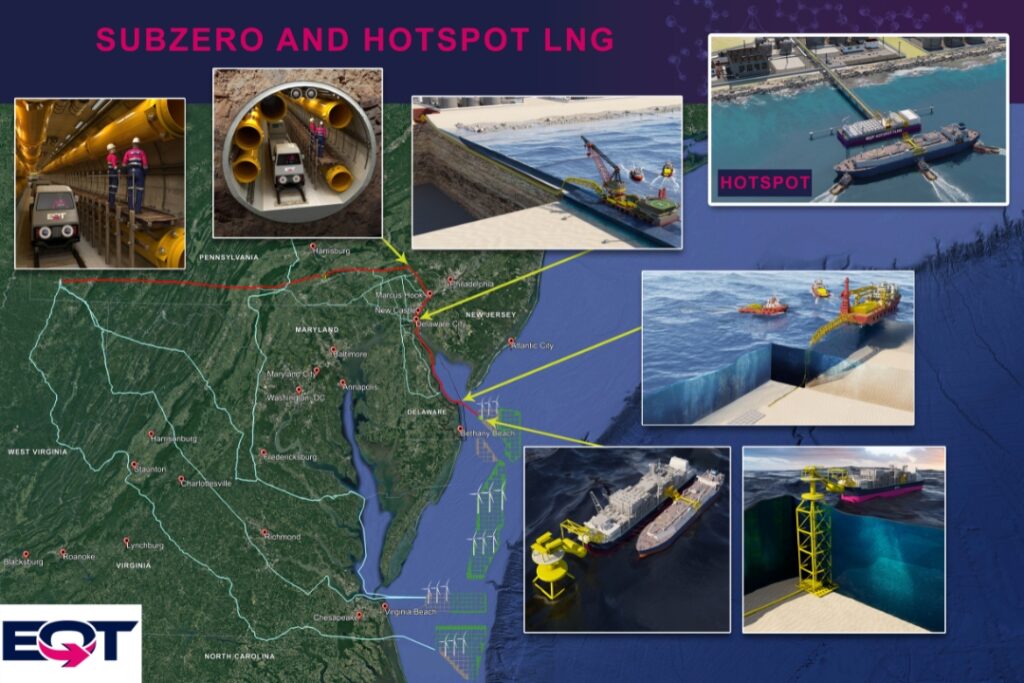
Austin Visuals helps mining, mineral exploration, engineering, and industrial clients create 3D animation for mineral exploration, resource communication, investor presentations, technical explainers, and stakeholder outreach. Our team can turn geology, drilling, resource models, and project strategy into clear visual content that different audiences can understand.
Our workflow typically begins with a discovery call, reference review, and communication goal. We look at the available data, audience, timeline, and intended use. Then we plan the script, visual sequence, style, and review process. For technical projects, we expect review from geologists, engineers, consultants, or internal subject matter experts before final delivery.
Austin Visuals can create terrain scenes, drill hole animations, block model visuals, geological 3D animation, investor presentation videos, trade show loops, website visuals, and internal training content. We can also adapt one core visual system into several deliverables so the project can be used in multiple settings.
Because we also produce industrial animation, technical animation, legal visuals, product animation, and training content, we are comfortable working with complex information that needs to be accurate but understandable. For mineral exploration teams, that means visuals that support the science, the story, and the business goal without becoming unrealistic.
Our Clients include:

Common Mistakes to Avoid
The first mistake is making the ore body look too certain. Exploration is an interpretation process. Animation should distinguish known data from interpreted geometry and avoid implying that every surface or block is more precise than the data supports.
The second mistake is overloading the screen. Exploration projects can include many layers, but a viewer needs information in a sequence. Show terrain first, then drill holes, then geology, then target zones or resource models. A layered reveal is usually clearer than showing everything at once.
The third mistake is using unrealistic visuals. Fantasy crystals, glowing ore, dramatic underground fly-throughs, and unsupported color effects can weaken credibility. Mineral exploration animation should look professional and grounded, especially for investor or technical audiences.
The fourth mistake is skipping technical review. Animators can make a clean visual, but geologists and engineers need to confirm that the model, assumptions, and visual language are appropriate. Review should happen at storyboard, rough animation, and final stages.
Planning a Mineral Exploration Animation Project
Before production begins, define the audience. Is the animation for investors, technical staff, a conference booth, a website, regulators, internal leadership, or community communication? Each audience needs a different level of detail.
Next, define the central message. The animation might explain why a target is promising, how a resource model was developed, what the next drilling phase will test, or how a project fits into a broader regional setting. A focused message keeps the video from becoming a moving data dump.
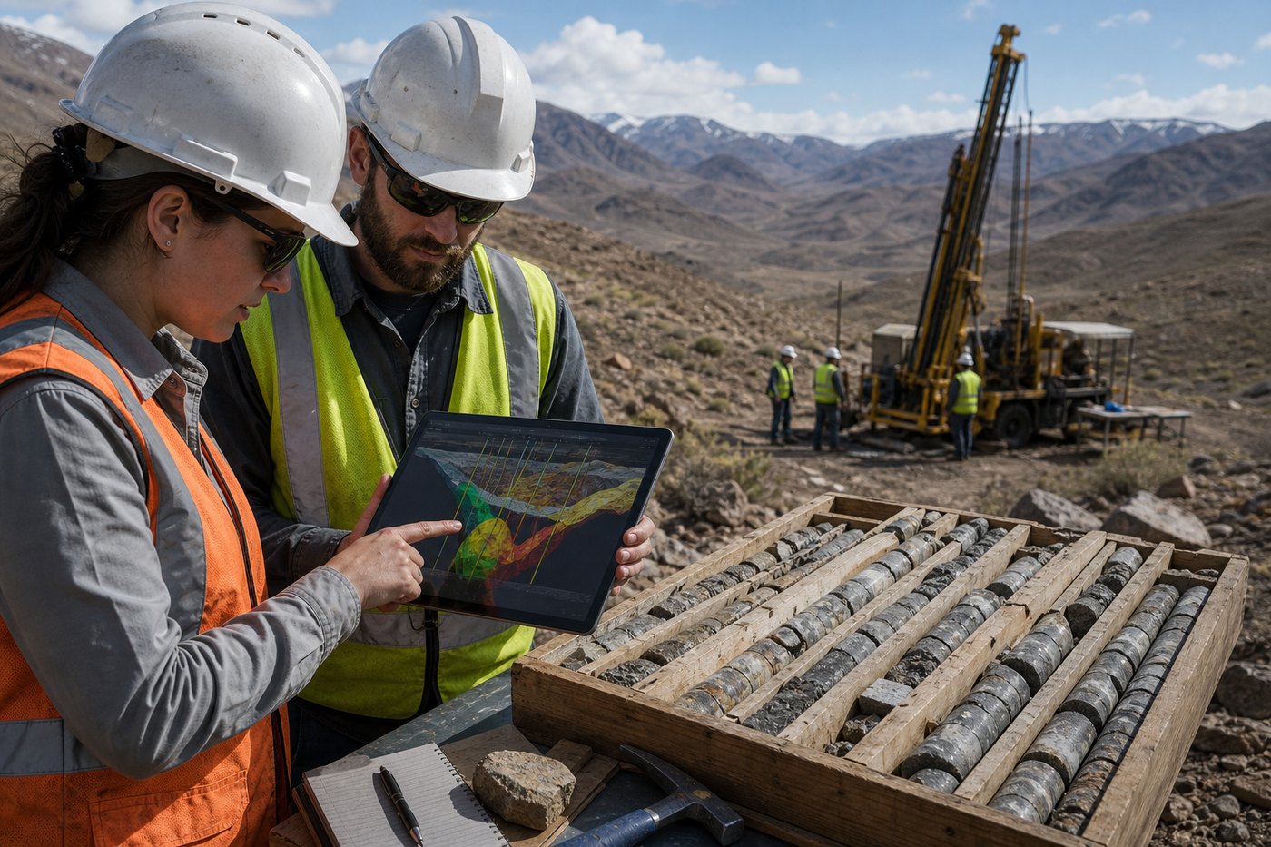
Then gather source materials. Useful references include maps, sections, drill hole data, surface imagery, model exports, core photos, site photos, brand guidelines, previous presentations, and technical reports. The more organized the references are, the smoother the production process will be.
Finally, plan for review. A mineral exploration animation should not be finalized without technical feedback. That review protects the project, improves clarity, and helps the final visual feel credible to both technical and non-technical audiences.
FAQ: 3D Animation for Mineral Exploration
What is 3D animation for mineral exploration?
3D animation for mineral exploration is an animated visual explanation of terrain, geology, drill holes, target zones, and resource models. It helps teams communicate exploration data to investors, technical reviewers, stakeholders, and internal decision-makers.
What data is needed to create mineral exploration animation?
Useful data may include maps, drill collar tables, downhole surveys, assays, lithology logs, block models, geological sections, GIS files, terrain data, drone imagery, site photos, and technical report figures.
Can animation show resource estimation and block models?
Yes. Resource estimation animation can show drill spacing, mineralized zones, grade shells, classification areas, and block model concepts when the technical team provides appropriate model data and review.
Is mineral exploration animation only for investors?
No. It can also support technical meetings, stakeholder outreach, permitting communication, internal planning, conference presentations, training, websites, and public project explanations.
How realistic should geological 3D animation be?
It should be realistic enough to communicate scale and relationships, but simplified enough to be understandable. The visual should avoid overstating certainty or showing unsupported geology.
How long should a mineral exploration animation be?
Many project overview animations are one to three minutes long. More technical modules can be divided into shorter sections that explain location, drilling, resource estimation, and next steps separately.
How can Austin Visuals help with mineral exploration animation?
Austin Visuals can help plan, script, model, animate, edit, and deliver mineral exploration animation for technical, investor, and stakeholder audiences. We work with client-provided data and subject matter review to keep visuals clear and credible.
Conclusion
3D animation for mineral exploration helps teams explain complex geology, drilling, and resource estimation in a way that is easier to understand. It can connect terrain, core data, drill traces, interpreted zones, and block models into one coherent visual story.
For exploration companies, the value is not just visual polish. It is clearer communication. A well-planned animation can support investor presentations, technical review, stakeholder outreach, internal planning, and project education while respecting the uncertainty and discipline of geological interpretation.
Austin Visuals helps companies turn equipment, workflows, safety procedures, products, and technical processes into clear visual content that teams and customers can understand.
Contact us at info@austinvisuals.com or call (512) 591-8024.